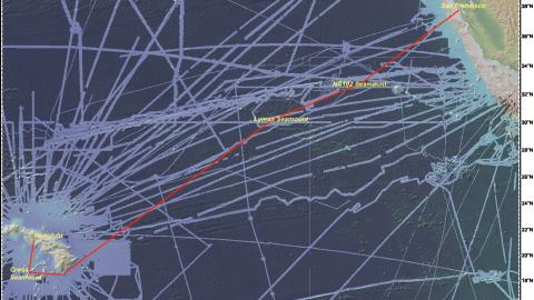

The expedition will focus on mapping from Honolulu to San Francisco, as the E/V Nautilus’ operations move back east to the US West Coast, in addition to the first deep water test of a new mobile ROV system. The mapping route has been planned to utilize the multibeam echosounder and sub-bottom profiler to fill in gaps in seabed mapping coverage across the Pacific.
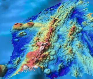
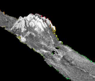
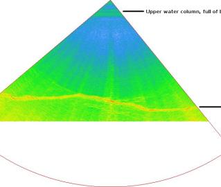
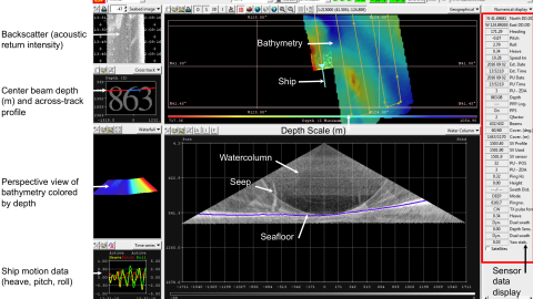
Systematic mapping of the seafloor by echosounder commenced nearly a century ago, however, more than 80% of the world’s seafloor is still not mapped, even at a resolution of 1km, and the eastern Pacific Ocean is no exception. The seafloor mapping by Nautilus plays an integral part with planning and successful execution of future ROV dives and other ocean observations. In addition to the direct value gained supporting Nautilus cruises, the seabed mapping data and products on this expedition directly contribute to international mapping efforts including the Seabed 2030 project.
In collaboration with the Woods Hole Oceanographic Institution and NOAA Office of Exploration & Research, OET has designed and built a sister ROV system to complement the Hercules and Argus ROVs. During this expedition, a variety of engineering tests will be conducted with ROVs Little Hercules, Atalanta, and supportive equipment.
Sponsored by: NOAA Office of Exploration and Research