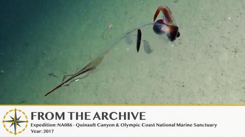
Exploring Olympic Coast National Marine Sanctuary & Quinault Canyon

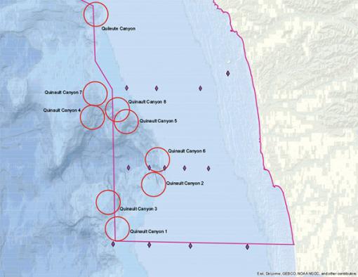
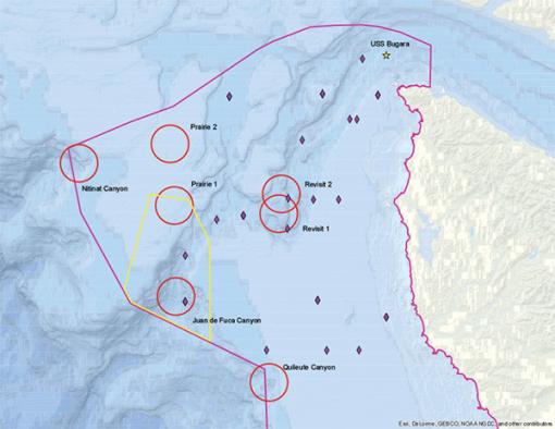
Returning to the Pacific Northwest, Nautilus will launch the next expedition from August 18 - September 4, 2017 to explore and characterize seafloor resources and features of the Olympic Coast National Marine Sanctuary, particularly within three prominent submarine canyons: Quinault Canyon, Quileute Canyon, and Juan de Fuca Canyon. Research partners for this expedition include NOAA Olympic Coast National Marine Sanctuary, NOAA Northwest Fisheries Science Center, the Quinault Indian Nation, and the University of Rhode Island.
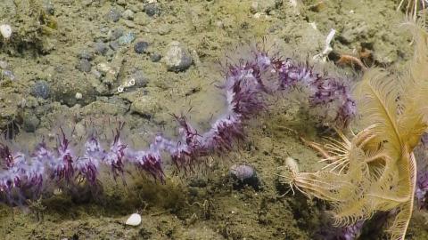
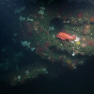
Resources to be explored through autonomous underwater vehicle (AUV) and remotely operated vehicle (ROV) deployment include a variety of habitats but will focus effort on characterizing rocky reef habitats that may harbor long-lived species, such as rockfish, deep sea coral and sponge communities, and other associated species. If located, the team will also document methane seeps, hundreds of which were found off the coasts of Washington and Oregon during the 2016 Nautilus expedition to Cascadia Margin. In Juan de Fuca Canyon, researchers will use ROV data collected during prior expeditions to revisit deep sea coral locations to study the condition of those organisms over time, as well as to expand understandings of complex and persistent rocky reef habitats. The team may also conduct multibeam sonar mapping of offshore priority areas.
Exploring With Coastal Treaty Tribes
Olympic Coast National Marine Sanctuary covers 3,189 mi2 of coastal and offshore waters along one of the least developed coastlines of the continental US. Though mapping efforts have helped to characterize seafloor substrates in some portions of the sanctuary, only very small portions of the sanctuary have been visited or photographed. Quinault and Quileute Canyons have never been explored by ROV or AUV, but are areas of high interest to expedition scientists, as well as to the Quinault Indian Nation, Quileute Tribe, Hoh Tribe, and Makah Tribe, the four native American tribes that have protected treaty rights to marine resources in this region. The mission is of special importance to these coastal communities, and tribal members will participate as scientists ashore and by hosting events within tribal communities.
Sentinel Site for Ocean Acidification
The Olympic Coast is also notable as the northern reach of the California Current ecosystem, where deep oceanic water is seasonally upwelled onto the shelf, bringing nutrient-rich waters nearshore. This process supports the region’s highly productive ecosystem, but due to ocean acidification (OA), is increasingly delivering corrosive low-pH, and often hypoxic, waters onto the shelf that produce detrimental effects to organisms, including ecologically, culturally, and commercially important species.
This expedition will be conducted near the end of the upwelling season and will involve collection of biological and deep water samples with the ROV, push cores of the seafloor as a historical record of OA exposure, and plankton samples from shelf break locations near the canyon rims. As an ocean acidification sentinel site, the Olympic Coast region is focused on understanding the physical, chemical and biological impacts from OA as well as piloting management approaches for monitoring and addressing OA impacts.
Rediscovering History: USS Bugara
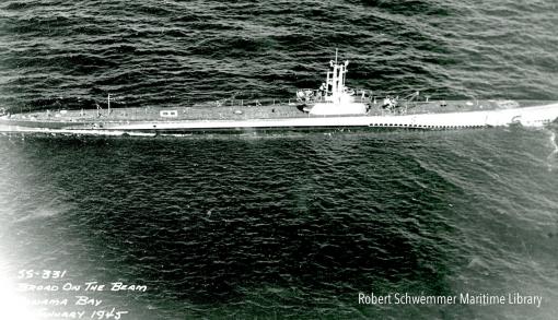
This expedition will also include the first archaeological survey of the USS Bugara, a World War II-era submarine. Using ROV Hercules and ROV Argus to document and survey the wreck from E/V Nautilus, this exploration will include scientists, archaeologists, historians, educators, and veterans who served on the submarine joining in from across the nation via telepresence.
USS Bugara is a U.S. Navy submarine that commenced war patrols in 1945 in the Java, Flores and South China seas, as well as the Gulf of Siam, and received three battle stars for its service in World War II. It later served in the Korean War and Vietnam War, and was decommissioned from the Navy on October 1, 1970. In 1971, while under tow to serve as a target vessel, the submarine began to take on water and foundered off Cape Flattery, Washington, with no one aboard as it sank. Bugara now lies at a depth of 800 feet within Olympic Coast National Marine Sanctuary. In 2001, during a remotely operated vehicle cable survey, the USS Bugara wreck site was confirmed and a non-archaeological reconnaissance inspection of the exterior hull was conducted. The results will be compared to the E/V Nautilus ROV survey, looking for possible changes in the hull over a 16-year span.
Expedition Objectives and Technology
- Explore, map and photograph shelf break and upper slope habitats within and adjacent to major submarine canyons through use of ROV Hercules, ROV Argus, and SeaBED Autonomous Underwater Vehicle (AUV) ‘Lucille’
- Measure water chemistry to understand ocean acidification dynamics
- Sample planktonic organisms (zooplankton and pteropods) with a series of bongo net tows to characterize the community, to better understand how ocean conditions may affect zooplankton, and to pilot a new OA biological indicator monitoring approach.
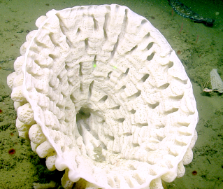
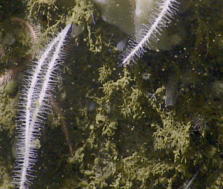
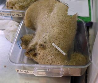
- Expand records of deep sea coral and sponge communities, and collect a limited number of specimens for scientific purposes including DNA barcoding, population study, validation of deep sea coral modeling efforts, and taxonomic confirmation of existing and new species.
- Revisit known deep sea coral locations from previous surveys in Juan de Fuca Canyon to track the condition of benthic communities over time.
- Visit and document the wreck of the submarine USS Bugara, a maritime heritage site near Cape Flattery, WA.
- Identify and document additional methane seep and hydrate locations when encountered.
Quinault Canyon & Olympic Coast National Marine Sanctuary
Returning to the Pacific Northwest, Nautilus will launch an expedition with dual objectives in Olympic Coast National Marine Sanctuary, covering 3,189 mi2 of coastal and offshore waters along one of the least developed coastlines of the continental US.