Science Overview: Exploring the Channel Islands National Marine Sanctuary

In 1972 Congress passed the National Marine Sanctuaries Act (NMSA), which directed the Secretary of Commerce and NOAA to identify, designate, and manage ocean and Great Lake areas of special national significance as national marine sanctuaries. This included the authority to adopt regulations and issue permits for certain activities, and requires each National Marine Sanctuary to have a management plan that is periodically reviewed and updated. Included in this management plan are regulations regarding fishing and other commercial activities. Within a sanctuary, there can be no discharge or disturbance of the sea/lake bed.
The Channel Islands National Marine Sanctuary (CINMS) is one of these Marine Sanctuaries and was formed in 1980 in conjunction with the Channel Islands National Park. Within CINMS, some areas have been established as Marine Protected Areas (MPAs) to restrict all fishing in order to protect “essential fish habitats” (NOAA.gov). In 2000, the definition of “essential fish habitats” was expanded to include corals which is, in part, a key reason we are documenting corals in this area.
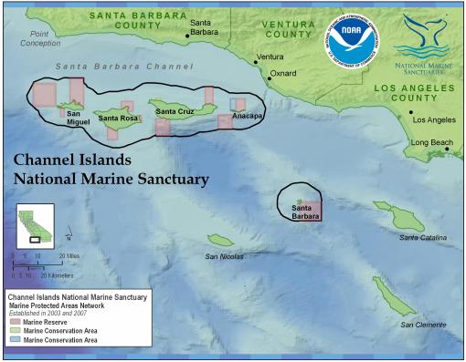
One of the goals of our exploration within CINMS was to explore unknown areas within the sanctuary as well as other areas surrounding the sanctuary to add context for the protected areas. Only about 50 percent of the sanctuary had been mapped. Understanding both the bathymetry as well as the relative hardness (rocky or sandy) of the sea floor helps scientists of the sanctuary to predict the types of organisms that may live in a specific area as well as provide the scientific evidence necessary to the development of management policies. Many of the dives and mapping conducted during this leg of the cruise were geared towards increasing our knowledge of the ecology and geology of the deep water areas surrounding the islands that had yet to be explored.
One of the areas we explored was Arguello Canyon off the coast of Point Conception, just north of Santa Rosa Island. This area is being considered for the designation of a Chumash Heritage National Marine Sanctuary. According to the Northern Chumash Tribal Council’s proposal, the sanctuary will protect an abundantly rich and diverse marine ecosystem that is a nursery and home for many fish and marine mammal species, and a migration lane for seven species of whales and six types of dolphins and porpoises, a diverse fishery, and many more seals, otters, and marine wildlife. (http://www.nominate.noaa.gov/nominations/nomination_chumash_heritage.pdf) This area is also of particular importance to the Chumash people as it represents an important part of their martime history.
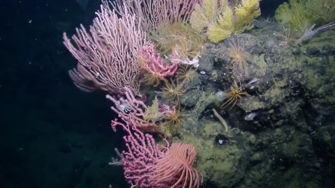
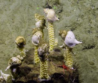
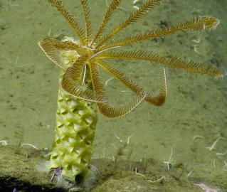
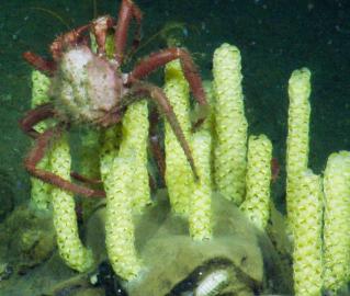
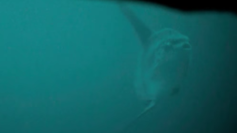
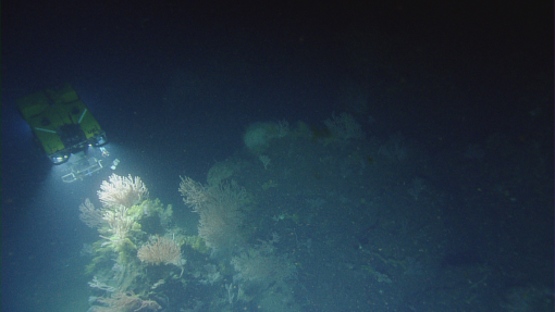
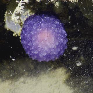
In order to aid NOAA in their research of the National Marine Sanctuary and surrounding areas, E/V Nautilus and the Corps of Exploration utilized their multibeam mapping sonar and ROVs Hercules and Argus to map and ground truth the areas of interest, including Arguello Canyon. While creating high resolution maps, the team flags interesting areas of data as dive targets for Hercules and Argus to investigate. The vehicles traveled along the ocean floor and canyon walls filming the different types of organisms in the area. The team was specifically searching for densities of deep water corals which can be designated as coral gardens (at least 1 coral per square meter over 100 meters). Using the ROVs, the team performed 15 minute transects at a constant velocity and altitude so the video data could be used to calculate coral density at various locations across the marine sanctuary. Habitat maps, like these, are crucial in designating new MPAs (marine protected areas), as well as establishing better databases for the locations, depths, and water conditions corals are found around the world.
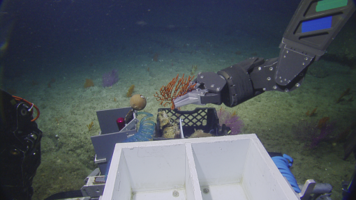
During this expedition, We collected over 120 samples of corals, water, sediment cores, and rocks which will be preserved and catalogued for use by the scientific community. Some of the live coral samples we collected will be brought back to the lab of Dr. Etnoyer, the lead scientist on this expedition, to be tested for their tolerance of changing water conditions including pH, temperature, and dissolved solutes. One of Dr. Etnoyer’s research interests included how tolerant these deep sea corals are to fluctuations in temperature following the frequent El Nino events of the last decade.
It has been an honor to work here in the Channel Islands National Marine Sanctuary. CINMS is truly a remarkable place with rich history, fascinating geology, and diverse ecology. It is our hope that the research we conducted here will add to the scientific body of knowledge, provoke further study of the area, and help to establish better informed policy on the creation, management, and conservation of marine protected areas for the enjoyment of future generations.
Channel Islands National Marine Sanctuary
The deep-water biological habitat and geological character of the seafloor around the Channel Islands are poorly understood despite considerable research in the area and a number of special designations in place to protect these regions. Less than 50% of the seafloor within the boundaries of the Channel Islands National Marine Sanctuary (CINMS) has been mapped by high-resolution sonar.