Mapping Pacific Seamounts and Testing New Technology

After a chock-full exploration of the diverse deep-water regions of Baker and Howland Islands and Johnston Atoll, E/V Nautilus is heading back to the mainland! While in transit from Honolulu to San Francisco between September 18 and October 2, our team will be filling in the gaps of seabed mapping coverage across the Pacific Ocean in a select number of targeted areas.
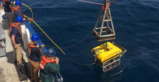
The transit will first proceed south of Honolulu to Cross Seamount as we test Little Hercules and Atalanta, a sister ROV system to complement ROVs Hercules and Argus, designed and built by the Ocean Exploration Trust in collaboration with Woods Hole Oceanographic Institution and NOAA Office of Exploration and Research. This new telepresence-enabled mobile system has the flexibility of operating from a wide variety of commercial and academic research vessels while exploring depths of up to 6,000 meters (19,685 feet) in high-definition 4K resolution. This expedition will include the first deep-water test of the system to be deployed in 2020.
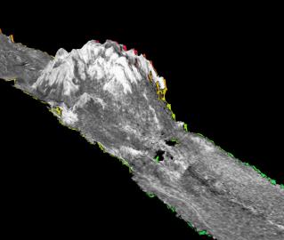
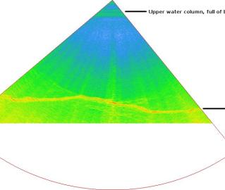
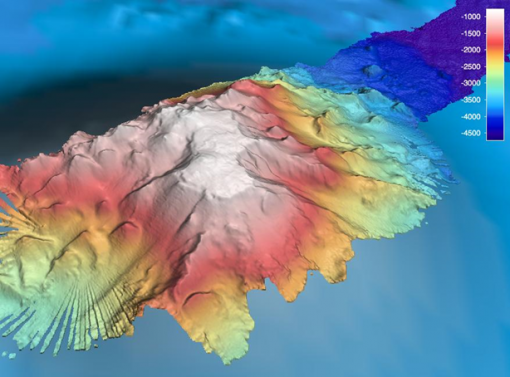
Following these tests, the Nautilus will transit east toward San Francisco as we undertake mapping in an area around the Lyman Seamount before continuing to a second series of ROV dives on an unnamed seamount first mapped in 2018 located about 500 nautical miles from the U.S. west coast. On completion of these dives, the transit route will follow an eastward passage over uncharted regions by utilizing the multibeam echosounder and sub-bottom profiler to continue mapping the seafloor.
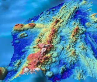
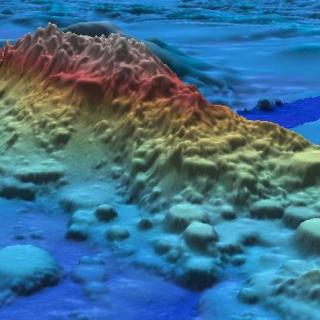
Systematic mapping of the seafloor began more than a century ago, yet 80 percent of the seafloor remains unmapped. A majority of our transit aligns with mapping needs set forth by Seabed 2030, an international project initiated by global leaders with the goal of having 100 percent of the world’s seafloor topography mapped within the next decade. To that extent, we will track over areas of the seafloor that have never been explored, as well as unmapped seamounts identified from current global bathymetry models.
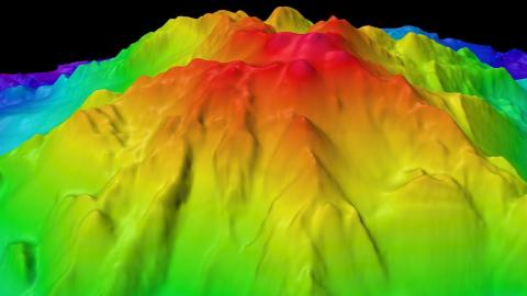
Of particular interest is surveying North Pacific seamounts with summits shallower than 1,500 meters (4,920 feet) that may be potential targets for deep-sea bottom fishing. The newly created North Pacific Fisheries Commission, in which the United States participates, has been set up to manage these fisheries, including protecting vulnerable marine ecosystems, such as deep-sea coral and sponge habitats.
During this transit, our team is also collaborating with the National Geographic Society, which is providing a specialized high-definition dropcam to explore the ocean depths. The Deep Ocean Dropcam was developed by National Geographic Exploration Technology Lab to withstand pressure found in the deepest part of the ocean using a specially designed housing equipped with onboard lights to illuminate the seafloor. First employed by the Nautilus last year during a mapping expedition over the Clarion-Clipperton Fracture Zone, the camera is weighted and drops to the sea floor where it is programmed to record for a number of hours. When done recording, the camera freely floats to the surface for recovery.
Another objective during this cruise includes this season’s final deployment of two Scripps Institution of Oceanography miniature wave buoys that will be used to collect data for wave parameters, sea surface temperature, as well as course and speed over ground. These will be the ninth and tenth deployments from our vessel this expedition season.
Pacific Seamounts
The expedition will focus on mapping from Honolulu to San Francisco, as the E/V Nautilus’ operations move back east to the US West Coast, in addition to the first deep water test of a new mobile ROV system. The mapping route has been planned to utilize the multibeam echosounder and sub-bottom profiler to fill in gaps in seabed mapping coverage across the Pacific.